
Project Description
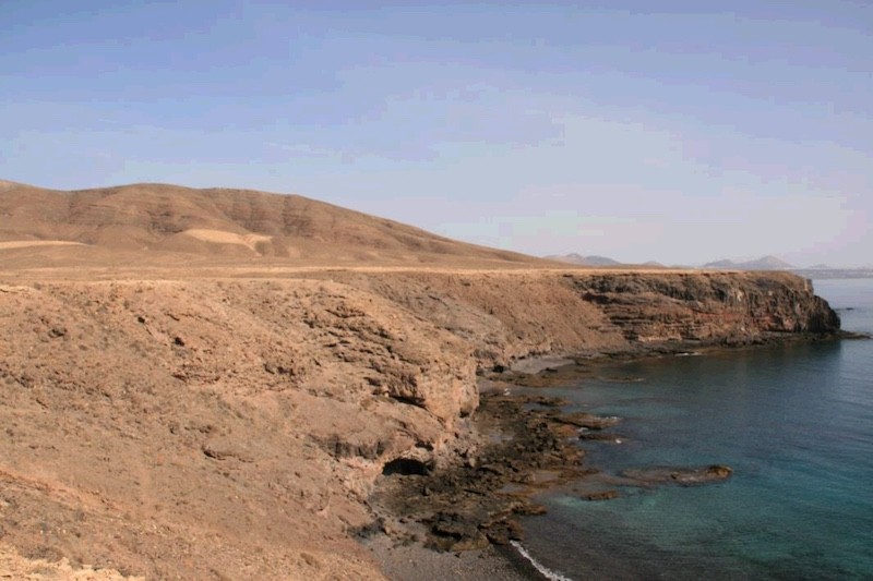
In the southeastern tip of Lanzarote, south of the steep slopes of Los Ajaches, a large area of very low slope is located. It is a marine abrasion platform formed during the Pliocene, on which a river network of dendritic character has formed. This rasa has an average altitude of about 40 m above sea level. At its mouth, organogenic sand beaches and climbing dunes are formed. On the cliffs you can see the rocks belonging to the Ajaches structures, with frequent stacks of lava flows separated by Almagres and significant discrepancies. These deposits are crossed deeply by numerous dykes and intersected by faults. In some cases the dams can form positive reliefs, as they are composed of much harder rock than the rocks that are intersected, so they are more resistant to erosion.
This geosite is a primary concern of geomorphological type, but due to its size and the variety of geological processes that it includes, it also has volcanological, tectonic, sedimentological, stratigraphic and paleontological interest. This is an area of spectacular scenic contrasts. This geosite is included in the Monumento Natural de Los Ajaches and has been declared as ZEPA (Spanish acronym, Natural Protected Area).