
Project Description
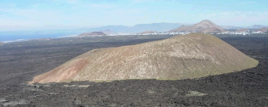
This geosite includes the surface of the volcanic cone of La Caldereta formed during the Lower Pleistocene. The vastness of its lava flows during the eruption that took place between 1730 and 1736, resulted in a large lava area; only locally, the existence of previous mountain ranges, mainly volcanic cones, posed an obstacle to the lava, making it have to go around these obstacles and generate spaces leaving areas uncovered locally called “islotes” or kipukas in Anglo-Saxon terminology. The bottom of La Caldereta crater is 50 m below the base of its exterior flanks. The ochre shade of its hillsides, caused by the transformation of the material on its floor, make it stand out noticeably in the landscape as it is surrounded by the dark flows of the Timanfaya lava.
geosite with a mainly geomorphological interest, and a secondary volcanological and stratigraphic interest. This is one of the best examples of and “islet” in the Canary Islands.
geosite with a mainly geomorphological interest, and a secondary volcanological and stratigraphic interest. This is one of the best examples of and “islet” in the Canary Islands.