Project Description
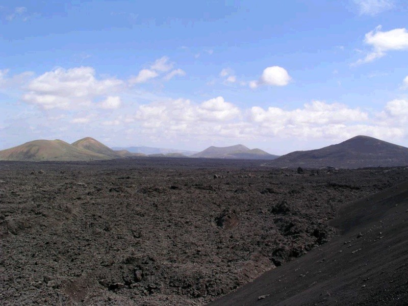
The 1730-1736 Timanfaya eruptions resulted in one of the largest and most long-lasting superficially historical lava fields. During the eruptions, the lava flows covered an area of around 176 km2, forming piled up lava that in some points reach a power of up to 100 m according to data obtained from deep surveys carried out at the end of the 1990’s. Part of the lava flows were drained towards the west of the island until they reached the sea, forming broad lava ramps with different types of superficial morphologies characteristic of pahoehoe basaltic lava (cemented, roped, digitadas, dented, en tripas) and aa (typical, with blocks and transition among them). Structures such as tumulus and mega tumulus, lava channels, tubes and micro tubes, bridges, hornitos and jameos, etc., are also frequent. Towards the inside of the island, the lava covered old valleys and meadows between the volcanic pleistocene alignments silting and making large cereal harvest areas disappear.
This geosite has a main volcanological interest, as well as geomorphological and petrological. It’s part of the internationally renowned Geosite “VC007 Parque Nacional de Timanfaya”. The eruption of this lava had great social implications on the island. The landscape created by the lava and the different morphologies make it spectacular. A large part of this geosite is part of the Timanfaya National Park and Los Volcanes Natural Park.